

Navionics
Navionics NAUS007R - U.S. East - Navionics+
Navionics NAUS007R - U.S. East - Navionics+
SKU:OM-NAVIONICS-NAUS007RUS-010C137030
Low stock: 5 left
Couldn't load pickup availability

Overview
NAUS007R - U.S. East - Navionics+
Get the world’s No. 1 choice in marine mapping - with the best, most up-to-date Navionics+ cartography on your compatible chartplotter.
For offshore or inland waters, this all-in-one solution offers detail-rich integrated mapping of coastal waters, lakes, rivers and more. Get SonarChart™ 1’ (0.5 meter) HD bathymetry maps, advanced features such as dock-to-dock route guidance technology, live mapping and Plotter Sync to provide wireless access to daily updates.
The Navionics Chart Installer software also ensures the freshest chart data every time out. Navionics dock-to-dock route guidance solutions give you a suggested path to follow through channels, inlets, marina entrances and more. Multiple shading options aid in shallow water navigation and make it easy to highlight a target depth range for the best fishing spots.
Chart Code - NAUS007R
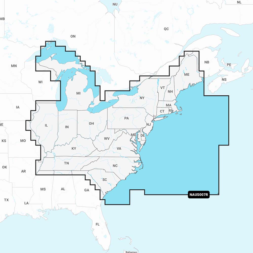
Coverage Area:
Coverage of the lakes, rivers and coasts of Connecticut, Delaware, Illinois, Indiana, Kentucky, Maine, Maryland, Massachusetts, Michigan, New Hampshire, New Jersey, New York, North Carolina, Ohio, Pennsylvania, Rhode Island, South Carolina, Tennessee, Vermont, Virginia and West Virginia.
Features:
- Nautical Chart – Comprehensive charts are derived from multiple officials, government, and private sources, displayed in a familiar look and feel
- SonarChart HD Bathymetry - Innovative 1' (0.5 m) bathymetry charts are created by using Navionics proprietary systems that augment existing content with sonar data contributed by the boating community
- Community Edits - Get useful local knowledge from edits made by users of the Navionics Boating app on your compatible smart device.
- Daily Updates - Up to 5,000 daily updates to our charts give you the most accurate, most current Navionics data available.1
- Dock-to-dock Route Guidance2 - Start your trip with a suggested path.
- SonarChart Live Mapping - Watch new HD depth maps develop in real-time as your boat moves through the water.
- Advanced Map Options - Customize your view to focus on the details that matter most
- Plotter Sync1 - Transfer routes and markers, update chart layers, and more - between your compatible chartplotter and the Boating app.
Compatibility:
- Check the compatibility of Navionics+ content and features with your GPS chartplotter.
Technical Specifications:
- Format - SD/MSD Card
In the Box:
- SD/MSD Card
1Subscription not required for SonarChart Live mapping feature on some chartplotter models; requires latest chartplotter firmware release.
2Dock-to-dock Route Guidance is for planning purposes only and does not replace safe navigation operations.
*Navionics+ and Platinum+ cards are not compatible with Garmin chartplotters.
*Sold as an Individual
This product may not be returned to the original point of purchase. Please contact the manufacturer directly with any issues or concerns.Specifications
| Brand | Navionics |
|---|---|
| Manufacturer part # | 010-C1370-30 |
| UPC | 821245991690 |
| Boxed dimensions | 6 x 4 x 1 in |
| Shipping weight | 0.2 lb |
Manuals & documents
Shipping & returns
Fast, tracked shipping
In-stock orders ship quickly with tracking. Oversized and freight items may ship separately and can take a little longer.
30-day returns
Request a return within 30 days of delivery. Authorized returns carry no restocking fee. Return shipping is paid by the buyer; items must be new and in original packaging. See our refund policy.
Authorized dealer
OutdoorsMarine is an authorized Navionics dealer. Every product is genuine and backed by the full manufacturer warranty.
Frequently bought together
Similar items you may like
Popular in Cartography
Top deals right now
Authorized dealer
Genuine products, full warranty.
Fast, tracked shipping
On in-stock marine gear.
Expert support
Talk to people who know the gear.
Secure checkout
Protected payments via Shopify.