

Garmin
Garmin BlueChart® g3 Vision® HD - VUS011R - Southwest Florida - microSD™/SD™
Garmin BlueChart® g3 Vision® HD - VUS011R - Southwest Florida - microSD™/SD™
SKU:OM-GARMIN-BLUECHARTG3VIS-010C071200
Low stock: 1 left
Couldn't load pickup availability

Overview
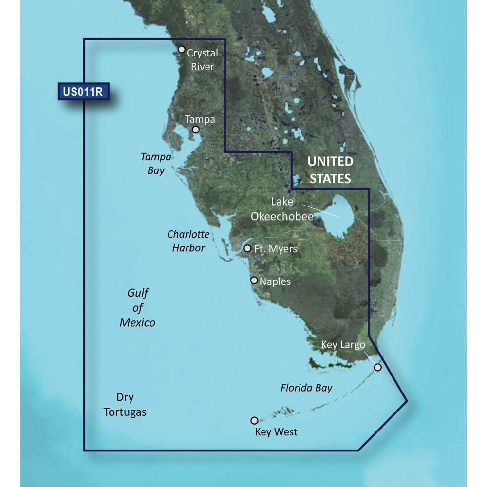
This Garmin BlueChart g3 Vision HD chart card covers Southwest Florida coastal waters on microSD/SD media. It is intended for boaters navigating from Crystal River through Key Largo, with detailed chart features for route planning, bottom detail and visual reference on compatible chartplotters.
- Chart region: VUS011R Southwest Florida
- Coverage: Crystal River through Key Largo, including Tampa Bay, Ft. Myers, Lake Okeechobee, Florida Bay, Key West and the Dry Tortugas
- Media format: microSD/SD
- Chart data: Integrated Garmin and Navionics data
- Auto Guidance: Uses desired depth and overhead clearance to calculate a suggested route for planning
- Bottom detail: High-resolution relief shading uses color and shadow to show structure
- Contours: Up to 1 foot contours
- Depth tools: Depth Range Shading with up to 10 depth ranges and Shallow Water Shading
- Imagery: High-resolution satellite imagery of ports, marinas, bridges and navigational landmarks
- Views: MarinerEye and FishEye 3-D views above and below the water line
- Additional cartography: NOAA raster cartography available as a free download through the ActiveCaptain app
- Navigation note: Auto Guidance is for planning only and does not replace safe navigation practices
Specifications
| Brand | Garmin |
|---|---|
| Manufacturer part # | 010-C0712-00 |
| UPC | 753759068929 |
| Boxed dimensions | 5 x 5 x 0 in |
| Shipping weight | 0.1 lb |
| Country of origin | UNITED STATES |
Manuals & documents
Shipping & returns
Fast, tracked shipping
In-stock orders ship quickly with tracking. Oversized and freight items may ship separately and can take a little longer.
Non-returnable item
This item cannot be returned once ordered, except where it arrives defective, damaged, or shipped in error. Please check fitment and specifications carefully before ordering. See our refund policy.
Authorized dealer
OutdoorsMarine is an authorized Garmin dealer. Every product is genuine and backed by the full manufacturer warranty.
Frequently bought together
Similar items you may like
Popular in Cartography
Top deals right now
Authorized dealer
Genuine products, full warranty.
Fast, tracked shipping
On in-stock marine gear.
Expert support
Talk to people who know the gear.
Secure checkout
Protected payments via Shopify.