Skip to product information
1 of 1

Furuno

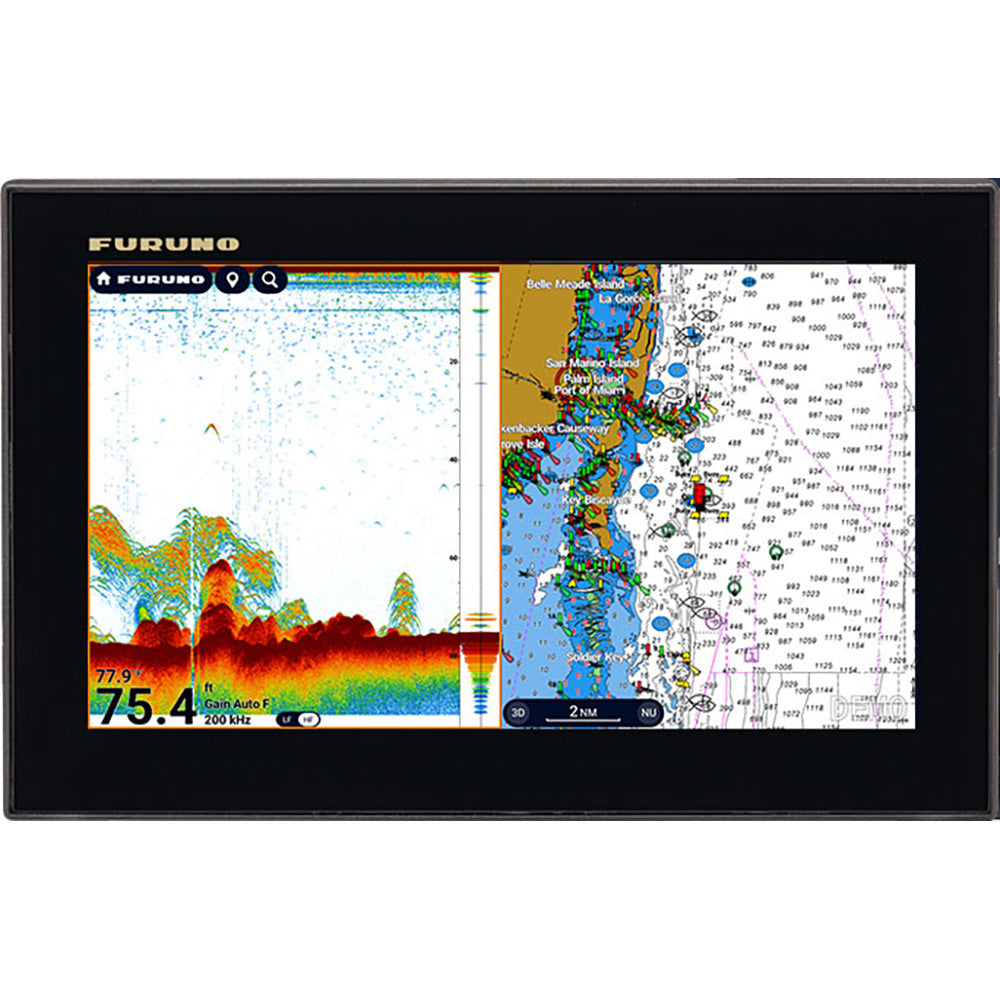
Furuno TZT9E Multi-Function Display Fishfinder/Chartplotter

Furuno TZT9E Multi-Function Display Fishfinder/Chartplotter

SKU:OM-FURUNO-TZT9EMULTIFUNC-TZT9E

Regular price $2,053.10
Regular price $2,195.00 Sale price $2,053.10
Sale Sold out
Shipping calculated at checkout.

Low stock: 1 left

Quantity
Authorized Furuno Dealer
Genuine product · full manufacturer warranty
Secure checkout via Shopify Payments
View full details

Overview

FurunoCartography Brand
9"Screen Size
YesTouchscreen
NoTransducer Included

TZT9E Multi-Function Display Fishfinder/Chartplotter

Scalable Integration with Serious Capability

The Navnet TZouch E Series, two fully networkable MFDs that deliver serious performance and system scalability to vessels of any size. The TZT9E and TZT13E go beyond stand-alone navigation. With full Radar compatibility, Sonar expandability, and integration with cameras, IP devices, and other sensors, these full-featured multi-touch MFDs are ready to grow with your boat. Built-in TruEcho CHIRP Fish Finder, CHIRP Side-Scan, and TZ MAPS support come standard, giving you a powerful suite of navigation tools in a clean, compact design

Whether you're building a full-featured helm or expanding your TZtouchXL network, these powerful 9- and 13-inch multi-touch IPS displays deliver advanced charting, Radar, Fish Finder, and video integration powered by the intuitive TZtouchXL platform.

Effortless Control

You asked for the simplest interface possible, and we were listening. We've delivered the most intuitive UI available, bar none, and you'll be navigating with all the power and simplicity you demand. If you swipe your phone, you can operate TZtouchXL. With edge-swipe features and single-tap menu options, you're never more than a tap or swipe away from what you want to see or do, because NavNet TZouchXL provides the easiest and most powerful MFD on the planet.

TZ MAPS

With TZ MAPS, navigators control what map data they want to download, such as incredibly wide chart areas, satellite photos, and bathymetric data. Purchase incredibly wide chart areas directly from the MFD! Custom depth color shading and bathymetric data overlays create navigational charts of unmatched detail and clarity, rendered with a variety of color themes to provide an electronic charting experience that goes far beyond any premium chart service before it. You can create your own custom objects or make updates to charted objects, such as buoys, so when they move from their previously charted positions, they can be updated on the system on the fly. Custom user objects can be shared with other registered TZ MAPS users through TimeZero's new moderated service, and can be turned on and off in the Layers menu, available with a single edge swipe up from the bottom of the display. Purchase of any TZ MAPS area also unlocks added functionality, such as powerful AI Routing that intelligently plans out routes, taking into consideration the boat's draft as well as charted depths and navigational obstacles. The purchase of any TZ MAPS chart unlocks those charts in the free TZ iBoat app for mobile devices such as a phone or tablet, providing you with a free home planning app that will transfer your points and routes directly to the TZtouchXL. With a free TimeZero account, waypoints and routes can be easily backed up or retrieved from the cloud with just a few taps, ensuring all the data you've worked so hard to create remains safe and secure.

Experience 'off-the-charts' bathymetric data with BathyVision

BathyVision for TZ MAPS provides truly 'off the charts' bathymetric data with contour lines that can be configured with a single tap. When we say configurable, we're talking down to a resolution of a mere 3 inches between contours - that's 3x better than any other bathymetric chart currently on the market. Bathymetric data is rendered from the same high-resolution database used for TZ MAPS' custom depth shading and can be overlaid onto the navigation charts to create fishing charts unlike any seen before.

Keep ahead of the conditions with TZ Weather

TZ Weather delivers enhanced situational awareness and forecasting for mariners worldwide. The free TZ Weather service delivers global and regional weather predictions from NOAA's Global Forecast System (GFS) for any area you determine. A premium subscription service provides the ability to download higher-resolution data from a number of global models, including ICON, NAM CONUS, Arpege, and AROME. You can configure your MFD to download the latest weather immediately on startup.

TZ Weather offers detailed and localized forecasts, allowing you to select forecast duration, resolution, and data models tailored to your needs. The streamlined Weather Timeline & Layers interface makes it easy to view and interact with forecasts, while animated particles, wind barbs, and color shading provide an intuitive representation of changing conditions. Additional tools, such as Meteograms and customizable presets, help you

Specifications

Cartography BrandFuruno
Screen Size9"
TouchscreenYes
Transducer IncludedNo
BrandFuruno
Manufacturer part #TZT9E
Boxed dimensions12 x 10 x 9 in
Shipping weight8.4 lb

Manuals & documents

Shipping & returns

Fast, tracked shipping

In-stock orders ship quickly with tracking. Oversized and freight items may ship separately and can take a little longer.

30-day returns

Request a return within 30 days of delivery. Authorized returns carry no restocking fee. Return shipping is paid by the buyer; items must be new and in original packaging. See our refund policy.

Authorized dealer

OutdoorsMarine is an authorized Furuno dealer. Every product is genuine and backed by the full manufacturer warranty.

Authorized dealer

Genuine products, full warranty.

Fast, tracked shipping

On in-stock marine gear.

Expert support

Talk to people who know the gear.

Secure checkout

Protected payments via Shopify.