
C-MAP
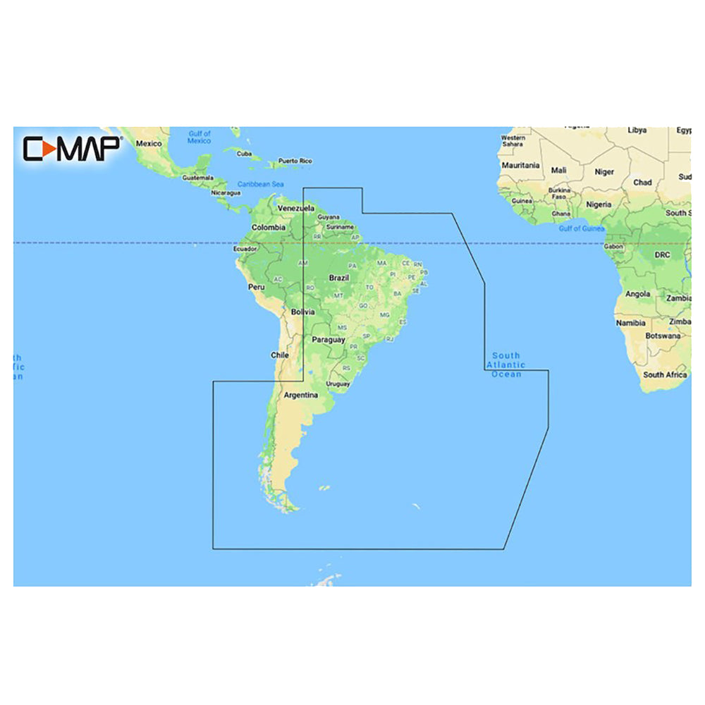
C-MAP REVEAL™ Chart - South America - East Coast
C-MAP REVEAL™ Chart - South America - East Coast
SKU:OM-CMAP-REVEALCHARTSOU-MSAY501MS
Low stock: 1 left
Couldn't load pickup availability

Overview
REVEAL™ Chart - South America - East Coast
The premium mapping solution for cruisers, anglers, and sailors looking for accurate, quality data with game-changing shaded relief from the market leader.
Cruising, fishing, or sailing, C-MAP® REVEAL™ Coastal charts offer the very best of C-MAP. With Shaded Relief, including game-changing Reveal Seafloor Imagery, Aerial Photography, Satellite Overlay, and Dynamic Raster Chart presentation added to the core C-MAP features found in DISCOVER™ – full-featured Vector Charts, with Custom Depth Shading, Tides & Currents and subscription-free Easy Routing™. It also includes the very best of C-MAP High-Res Bathy, including integrated Genesis® data. Purchase includes a full 12 months of free online updates.
Compatible with Lowrance, Simrad and B & G Chartplotters.
Features:
- Shaded Relief – bring the world around you to life, with 3D rendered land and underwater elevation – including areas of Ultra-High-Res Bathy seafloor imagery, previously only available in MAX-N+ Reveal – a game-changer for anglers.
- Full-Featured Vector Charts – making navigation easy by giving you accurate, up-to-date vector chart detail derive from official Hydrographic Office information.
- High-Res Bathy – helps you identify shallow areas, drop-offs, ledges, holes or humps. Now includes compiled and quality-controlled Genesis® detail as part of singular HRB layer.
- Custom Depth Shading – set a clear safety depth, maintain a paper-like view or create your own custom shading.
- Dynamic Raster Charts – providing the traditional chart look and feel, coupled with easy access to all objects on the chart.
- Easy Routing™ – helps you automatically plot the shortest, safest route based on detailed chart data and your personalized vessel information.
- Aerial Photography – a collection of thousands of photos of marinas, harbors, inlets and other notable navigational features included to offer an additional level of detail.
- Satellite Overlay – satellite imagery gives information about the surroundings when you find yourself in an unfamiliar place.
- Tides & Currents – shows projections of water level and direction of tides to help plan your day out, cruising, angling or sailing.
- Detailed Marina Port Plans – docking in an unfamiliar port is no problem when you have precise layouts of thousands of marinas, including slip spaces, restricted areas and other valuable navigation information.
- Harbor & Approach Details – an unprecedented level of detail. Approach any harbor and inlet with confidence. The perfect conclusion to a long voyage, sailing adventure or an exciting day of fishing.
- Online Updates – keep your chart up to date, with 12 months’ free online updates
Specifications
| Brand | C-MAP |
|---|---|
| Manufacturer part # | M-SA-Y501-MS |
| Boxed dimensions | 6 x 4 x 1 in |
| Shipping weight | 0.15 lb |
Shipping & returns
Fast, tracked shipping
In-stock orders ship quickly with tracking. Oversized and freight items may ship separately and can take a little longer.
30-day returns
Request a return within 30 days of delivery. Authorized returns carry no restocking fee. Return shipping is paid by the buyer; items must be new and in original packaging. See our refund policy.
Authorized dealer
OutdoorsMarine is an authorized C-MAP dealer. Every product is genuine and backed by the full manufacturer warranty.
Frequently bought together
Similar items you may like
Popular in C-Map Reveal
Top deals right now
Authorized dealer
Genuine products, full warranty.
Fast, tracked shipping
On in-stock marine gear.
Expert support
Talk to people who know the gear.
Secure checkout
Protected payments via Shopify.