

C-MAP
C-MAP MAX NA-M028 - Alaska - SD™ Card
C-MAP MAX NA-M028 - Alaska - SD™ Card
SKU:OM-CMAP-MAXNAM028-NAM028SDCARD
Low stock: 1 left
Couldn't load pickup availability

Overview
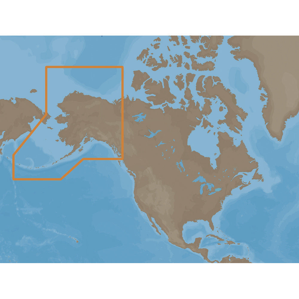
The C-MAP MAX NA-M028 SD card provides chart coverage for Alaska and surrounding northern waters. It is built for boaters navigating the southern Alaska coast, the Aleutian Islands, Bristol Bay, the North Slope area, and listed Canadian coverage.
- Product: C-MAP MAX NA-M028 Alaska chart card
- Media: SD card
- Coverage: Southern Alaska coast from Dixon Entrance to Kodiak Island
- Coverage: Aleutian Islands out to Attu Island
- Coverage: Bristol Bay
- Coverage: North Slope to Liverpool Bay in the Yukon Territory, Canada
- Additional coverage: MacKenzie River down to the 1160 km distance marker
- Returns: This product may not be returned to the original point of purchase; contact the manufacturer with issues or concerns
Specifications
| Card Format | SD |
|---|---|
| Brand | C-MAP |
| Manufacturer part # | NA-M028SDCARD |
| Boxed dimensions | 10 x 6 x 1 in |
| Shipping weight | 0.1 lb |
| Country of origin | US |
Manuals & documents
Shipping & returns
Free standard shipping
Standard shipping is free on every U.S. order — no minimum. Need it faster? Faster delivery options are available at checkout for qualifying orders. In-stock orders ship quickly with tracking; oversized and freight items may ship separately and can take a little longer. International rates are calculated at checkout.
Non-returnable item
This item cannot be returned once ordered, except where it arrives defective, damaged, or shipped in error. Please check fitment and specifications carefully before ordering. See our refund policy.
Authorized dealer
OutdoorsMarine is an authorized C-MAP dealer. Every product is genuine and backed by the full manufacturer warranty.
Similar items you may like
Popular in Cartography
Top deals right now
Authorized dealer
Genuine products, full warranty.
Fast, tracked shipping
On in-stock marine gear.
Expert support
Talk to people who know the gear.
Secure checkout
Protected payments via Shopify.